What to expect from the cold air that brought snow in Argentina
3 min read

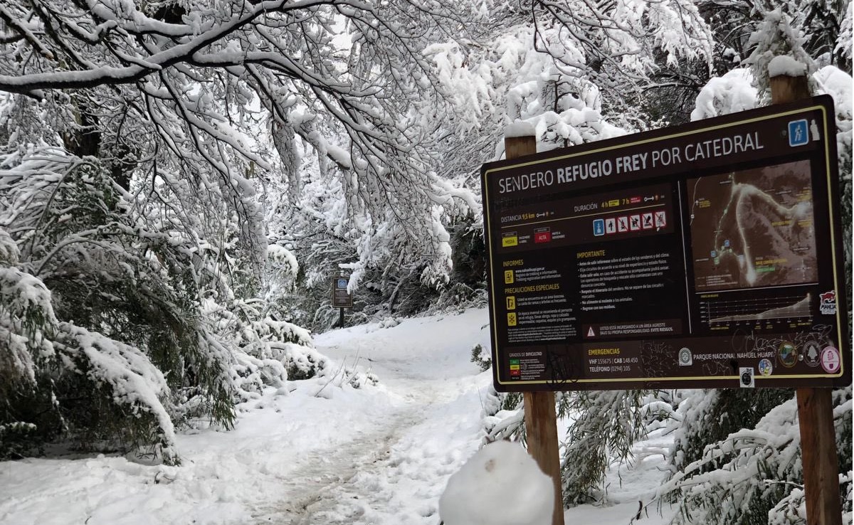
The cold front that began to enter Rio Grande do Sul with rain in some areas advances in front of a mass of cold air, which, when passing through Patagonia, brought snow in several locations between Thursday and today. Heavy snow fell and accumulated a few centimeters in the tourist town of Bariloche, and made for pretty winter postcards.
time | It’s snowing in Bariloche. It is now 1C at the local airport and snow has fallen at various times in the past few hours. through video @employee. pic.twitter.com/MxvqLHfMu3
– MetSul Meteorology (metsul) May 26, 2023
To the west, the blizzard that hit the Andean Cordillera closed road crossings between Argentina and Chile, especially in the Mendoza region, for days on end, leaving more than 1,500 trucks waiting to cross the border.
After removing snow and ice that had accumulated half a meter in some areas, the Christ the Redeemer Crossing was finally launched on Friday. The first vehicle crossed the border early Friday afternoon, but there was still a road ice warning for drivers.
Much of Patagonia dawned on Friday with temperatures below zero as a cold front dumped large amounts of rain in central Argentina with floods in Buenos Aires and Santa Fe. The temperature dropped to -4.9°C in Rio Gallegos and in the afternoon it was still snowing in Bariloche at 1°C.
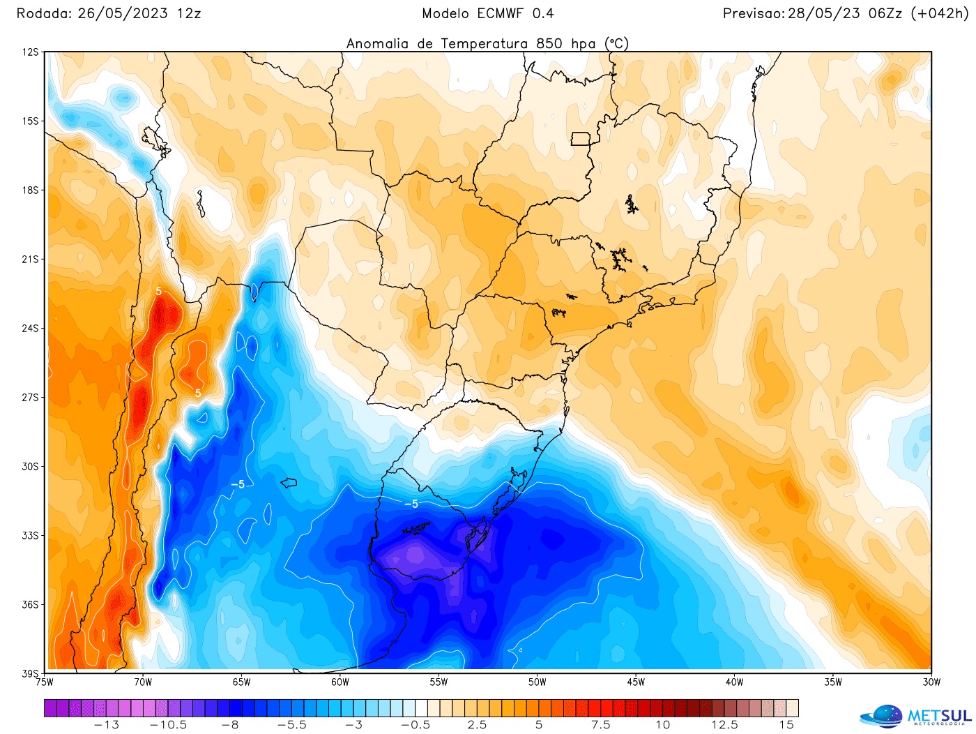
The cold air mass from the south of the continent is still strong in the Plata region, with very cold forecasts this weekend in both Buenos Aires and Montevideo, but it is supposed to weaken a lot upon reaching southern Brazil.
Therefore, the temperature will drop significantly compared to what has been recorded in recent days, with a dry spell above 30 ° C in Porto Alegre and the interior, but this incursion of cold air is far from strong and will disappoint many people. Caused by press reports, led to believe that the month will end very cold.
Will not! It will cool down, but nothing more. Even shyly by the standards of the end of May, when average temperatures are already close to June, one of the coldest months on the calendar in Rio Grande do Sul comes with July. In the vast majority of cities in Rio Grande do Sul, the minimum should not fall too much and will not exceed those recorded in the second week of this month.
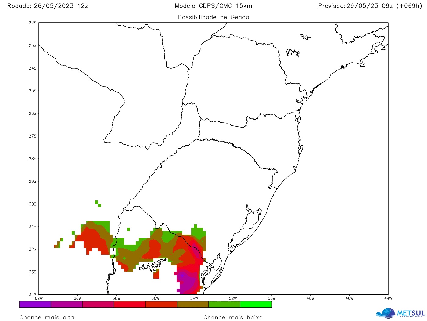
The greater influence of the cold air will be greater, yes, in the south of Rio Grande do Sul, in the Campaign and on the border with Uruguay, where the dawn must have a minimum, but for a short time. It should be the coldest on Monday morning, when it can be sleet and marks of 1°C to 3°C in parts of the region, but soon in the following days the minimum rises with marks above 10°C in most municipalities.
In the Porto Alegre area, the effect of cold air will be very modest. As there are clouds it won’t be too dry and the cold air tends to weaken, the lows over the next week should be around 15°C to 16°C in the botanical garden area most days and up to 13°C or 14°C some dawns . in the south of the city.
Therefore, almost no change is expected in relation to what was recorded in the last few days in the lower limits of the capital, even with periods of drought. The big difference would be in the maximums, much less than noted, but with pleasant afternoons when maximums exceed 20°C and even higher than normal for the season.
If in Porto Alegre there is almost no influence on the lower bounds, the same can be expected in the upper parts of the northeastern Rio Grande do Sul, in the Serra y Aparados, the coldest area of the Rio Grande do Sul. Sunday will be cool with rain and the temperature will drop in the afternoon in the region, between 11°C and 12°C in many cities, but next week the dawn will not be so cold at this time of year, the afternoon will be Pleasant it may rain again through the low pressure area to the north. (With cover image from Bariloche.org).

“Devoted food specialist. General alcohol fanatic. Amateur explorer. Infuriatingly humble social media scholar. Analyst.”


